Mapping, wayfinding and spatial AI for the transportation industry
Leverage interactive maps, indoor positioning and spatial computing to improve your users experience and boost operational excellence.




CASE STUDY
SNCF Gares & Connexions has deployed Wemap across 300 stations in France to map every area, and implemented Wemap Vision in over 40 stations for precise positioning without the need for infrastructure. The result: travelers gain greater autonomy, and the stations become more accessible.
See all case studies →300 stations
mapped across France, operated by SNCF Gares & Connexions
40+
stations with Wemap Vision — indoor positioning, no beacon
Zero beacons
360° low-cost capture — zero infrastructure to deploy or maintain
Dynamic recalc
route in real time — if the station live data changes, guidance adapts
CHALLENGES
Why transport leaders choose Wemap
Platform not found
"My travellers can't find their platform or connection — especially during disruptions."
Wemap calculates the optimal indoor + outdoor route and recalculates in real time if the platform changes. Several hundreds stations in production.
Beacons too costly
"Deploying beacons in open spaces covering several hundreds square meters is impossible — the maintenance cost would be prohibitive."
Wemap Vision positions from images — no beacon, no dedicated WiFi. Capture takes hours per site.
Blind underground zones
"Our operators get lost and maintenance interventions are slowed down because we lack a tracking system for our underground areas."
Wemap fuses 6 signal sources (GPS, VPS, WiFi, IMU, PDR, map-matching). Blue-dot continuity even in dead zones.
CAPABILITIES
The Wemap capabilities that make the difference in Transport & Mobility.
Multi-floor interactive maps
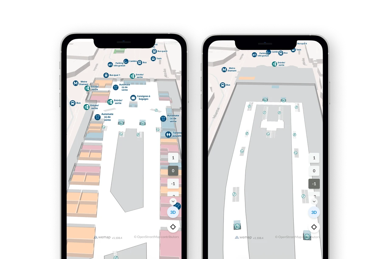
Georeferenced indoor station or terminal maps — halls, platforms, shops, services, accessibility routes. Native multi-floor, multi-profile (public, staff, contractors). Real-time data sync (service availability, incidents, construction changes).
For SNCB — major Belgian stations in 2D/3D with multimodal data and web integration deployed in weeks.
Step-by-step navigation & guidance
Indoor + outdoor route calculation in < 1 second, step-by-step guidance with text instructions and directional arrows, floor changes via escalator or lift, dynamic recalculation on disruption, full accessibility profiles. GTFS and GTFS-RT integrated for public transit connections.
For SNCF Gares & Connexions — real-time dynamic recalculation when platforms change. No guidance interruption.
Viewer and spatial AI
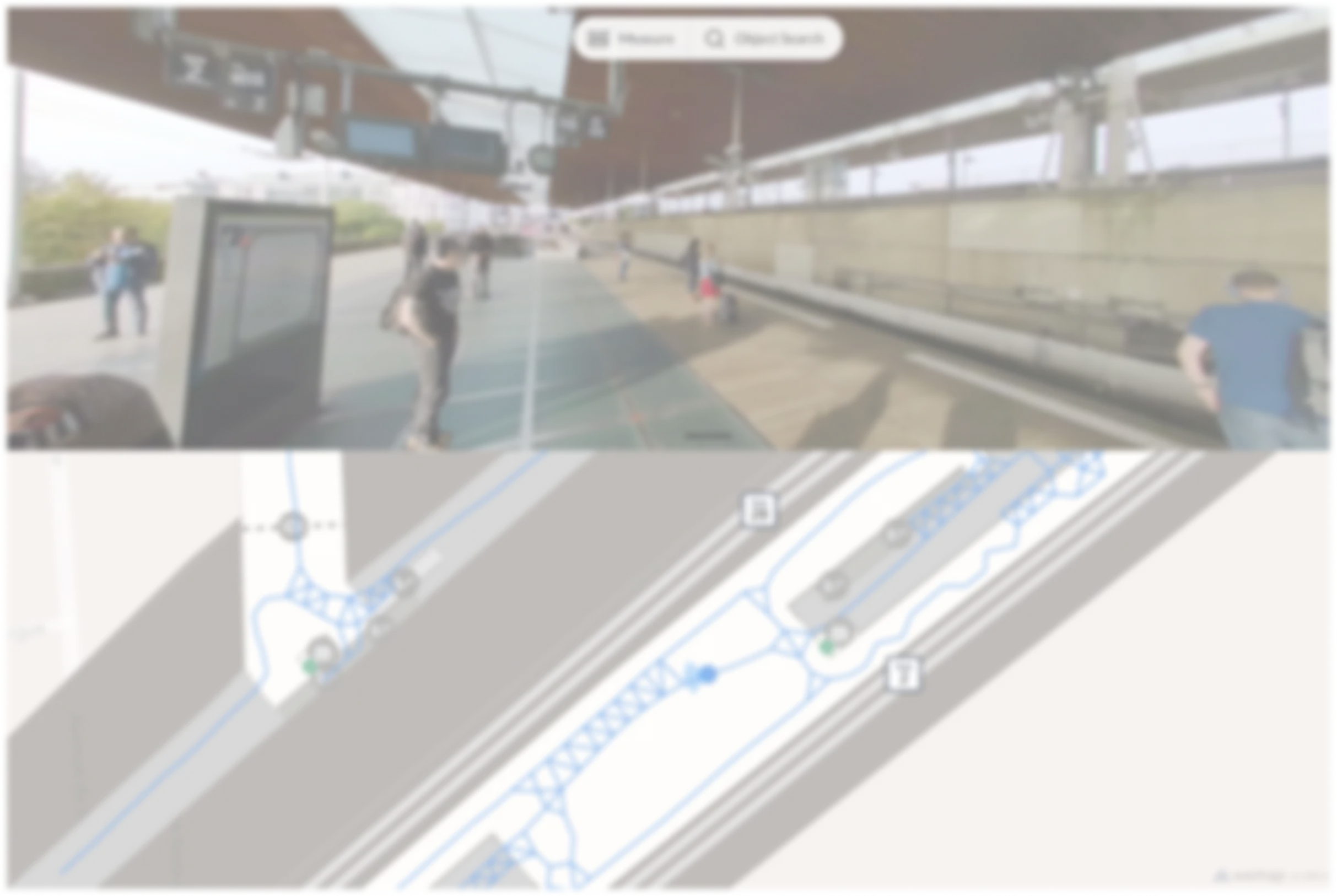
Immersive 360° viewer (Wemap Vision) to explore, annotate and document spaces. Spatial AI automatically detects equipment, signage and points of interest from captured images, with no manual input.
For RATP — 360° viewer deployed for station maintenance, optimising exploration and operator rounds across the Paris network.
Indoor Positioning
Precise indoor positioning from images, with no beacons or dedicated infrastructure. Fused with GPS, WiFi, IMU, PDR and map-matching for continuous blue-dot tracking, including underground or GPS-dead zones.
For TCL / Sytral — VPS deployed in Lyon metro stations, integrated with the Evelity app for visually impaired users.
Indoor <> Outdoor seamless transitions
Wemap positioning system enables location tracking and guidance from outside a terminal, station, or transport hub to the inside, and vice versa; regardless of their profile, users are effortlessly guided through the most complex transitions.
For a new metro station, Keolis Île-de-France offers a location and an ultra-accessible indoor-to-outdoor guidance system—all via a simple QR code.
AR orientation and step by step guidance
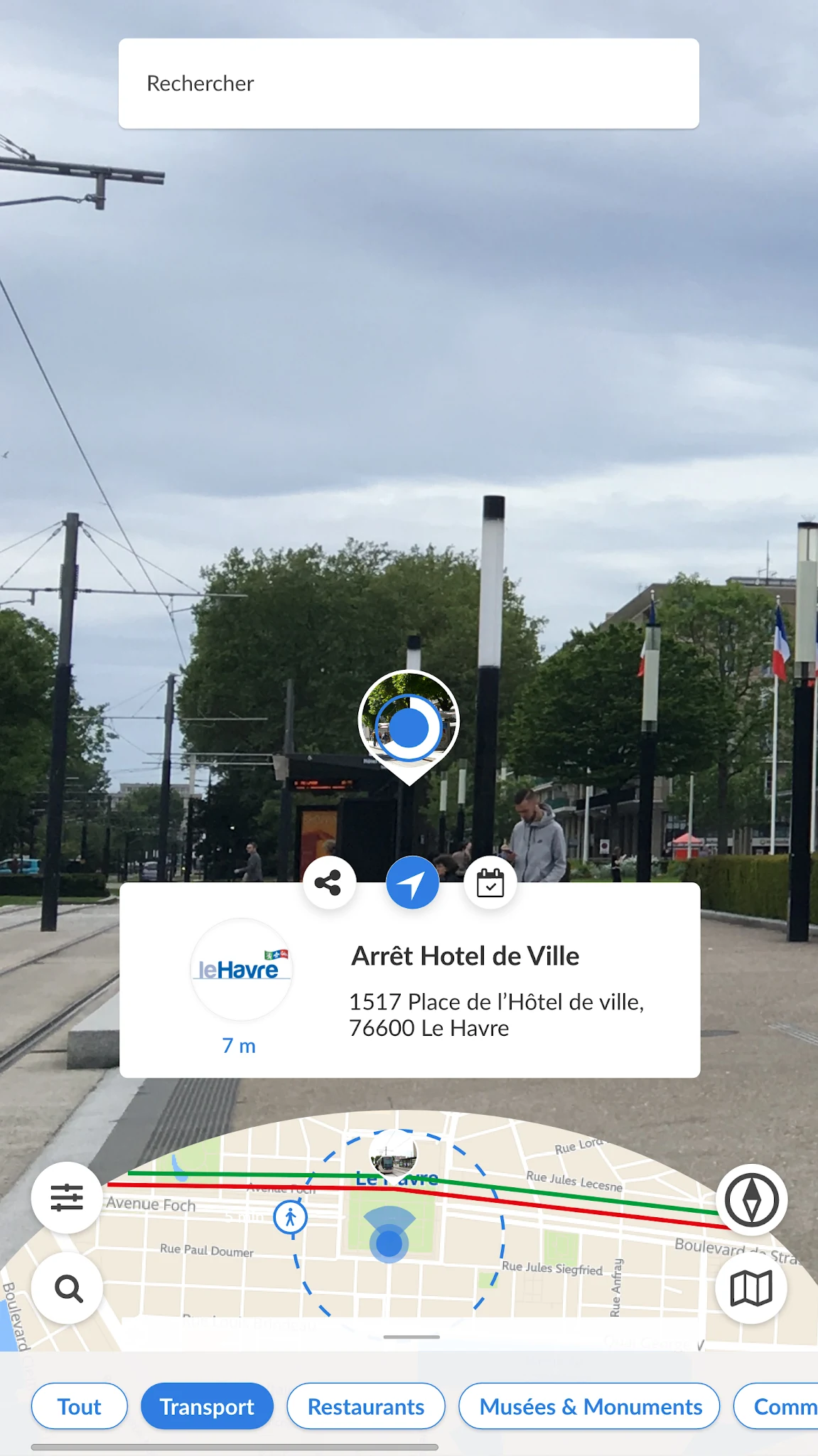
Augmented reality is leveraged to simplify and enrich the user experience in any setting: it offers a visual search tool for easy orientation and exploration of the surroundings, as well as immersive turn-by-turn navigation that streamlines the user journey.
JCDecaux has deployed Wemap with augmented reality in several cities to facilitate wayfinding to and around bus stops.
REFERENCES
Transport & Mobility — success stories.
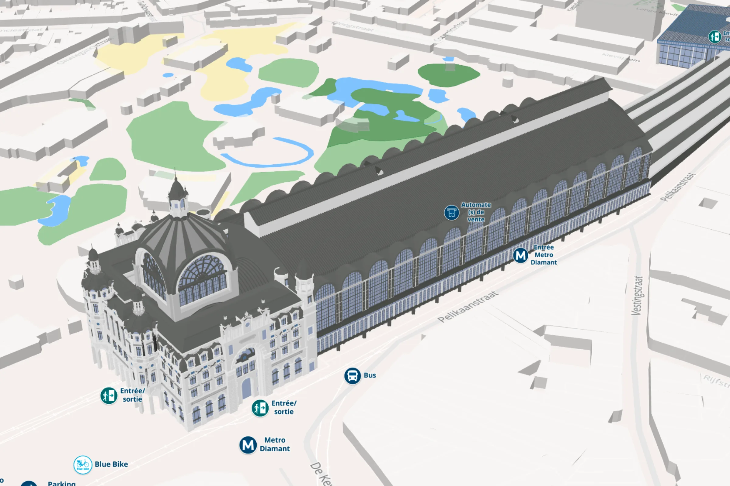
3D stations
Major Belgian stations — 2D/3D maps, multimodal data, web integration. Wemap Vision rollout underway.
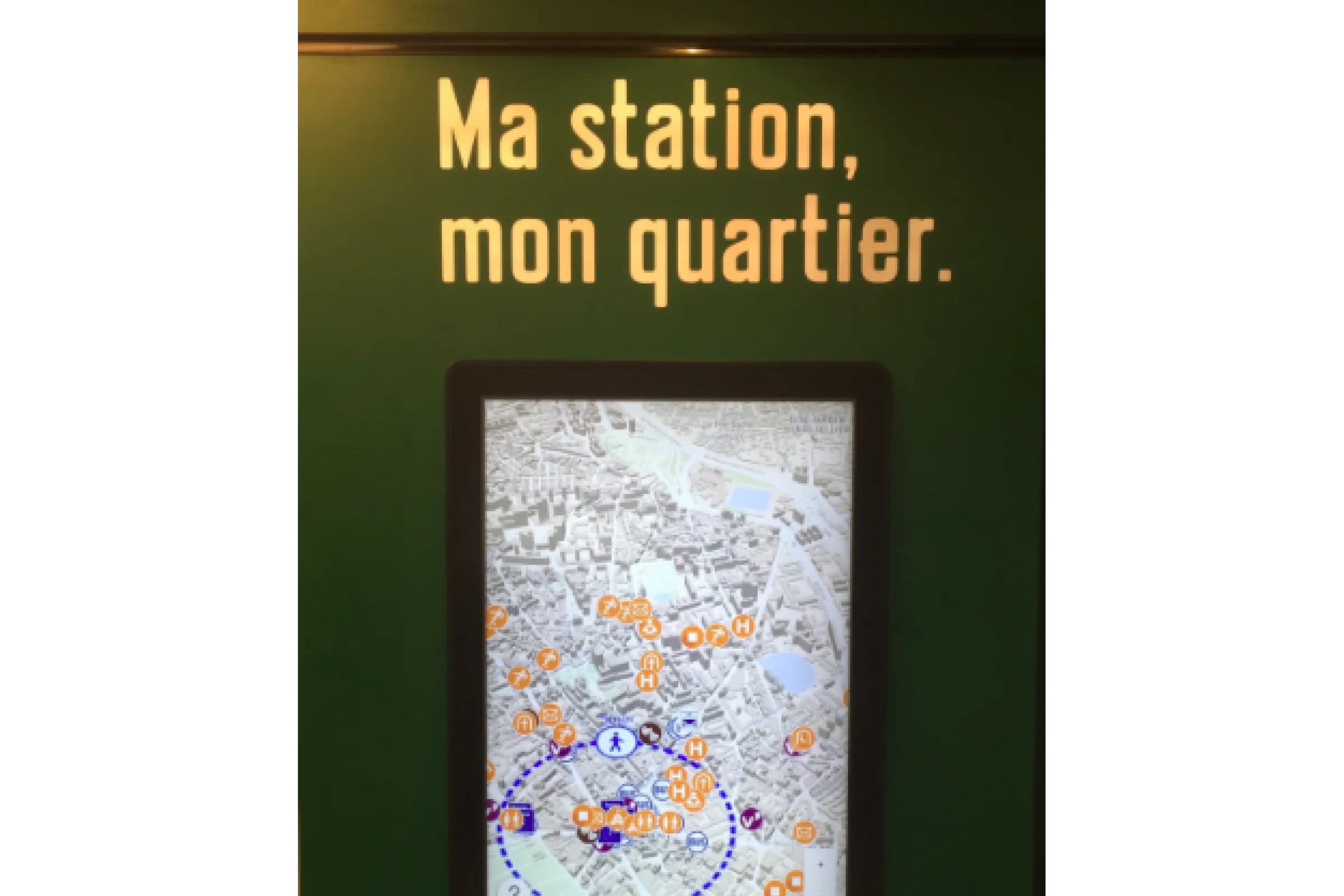
Interactive maps on touchscreen
Neighborhood and station maps featuring transit connection information and local businesses, displayed on station touchscreens. Transfer to users' smartphone for route details and navigation.
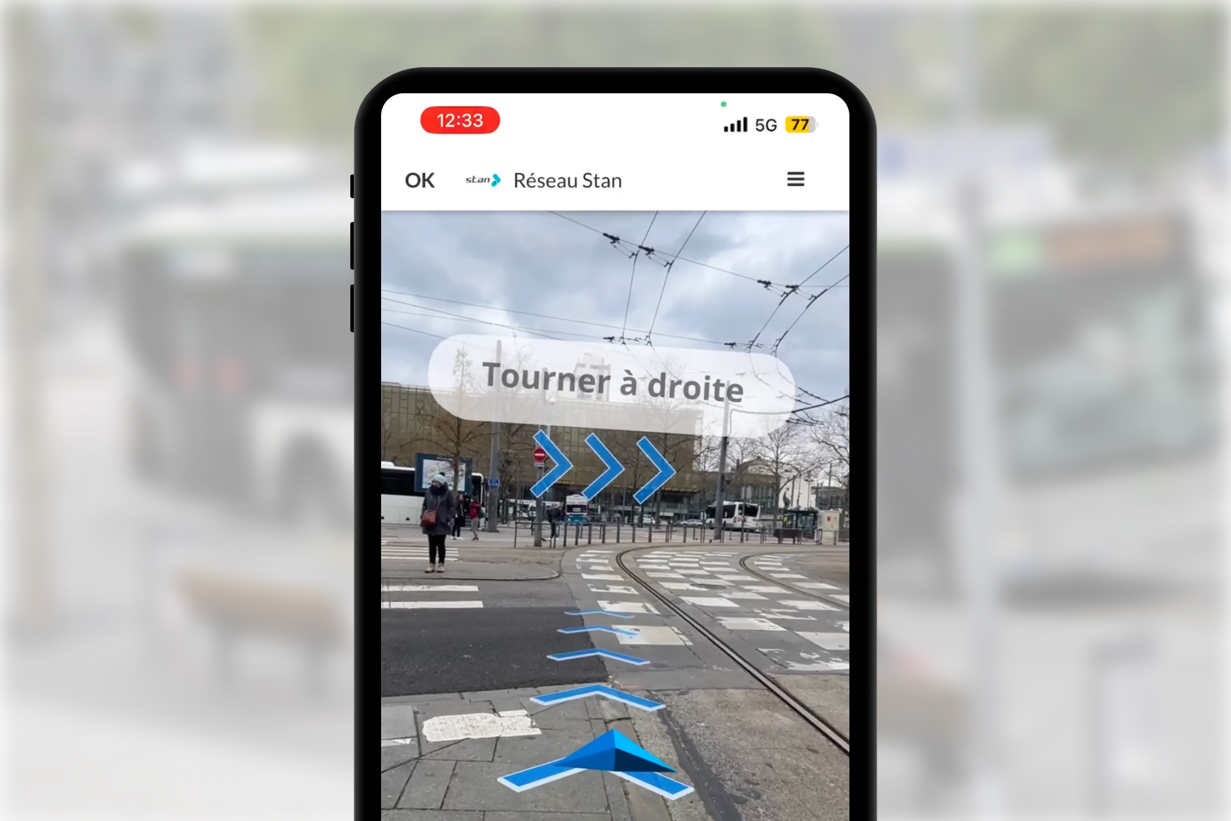
98% of users find AR useful
Pedestrian AR navigation during major network changes. GTFS data, voice instructions, outdoor guidance.
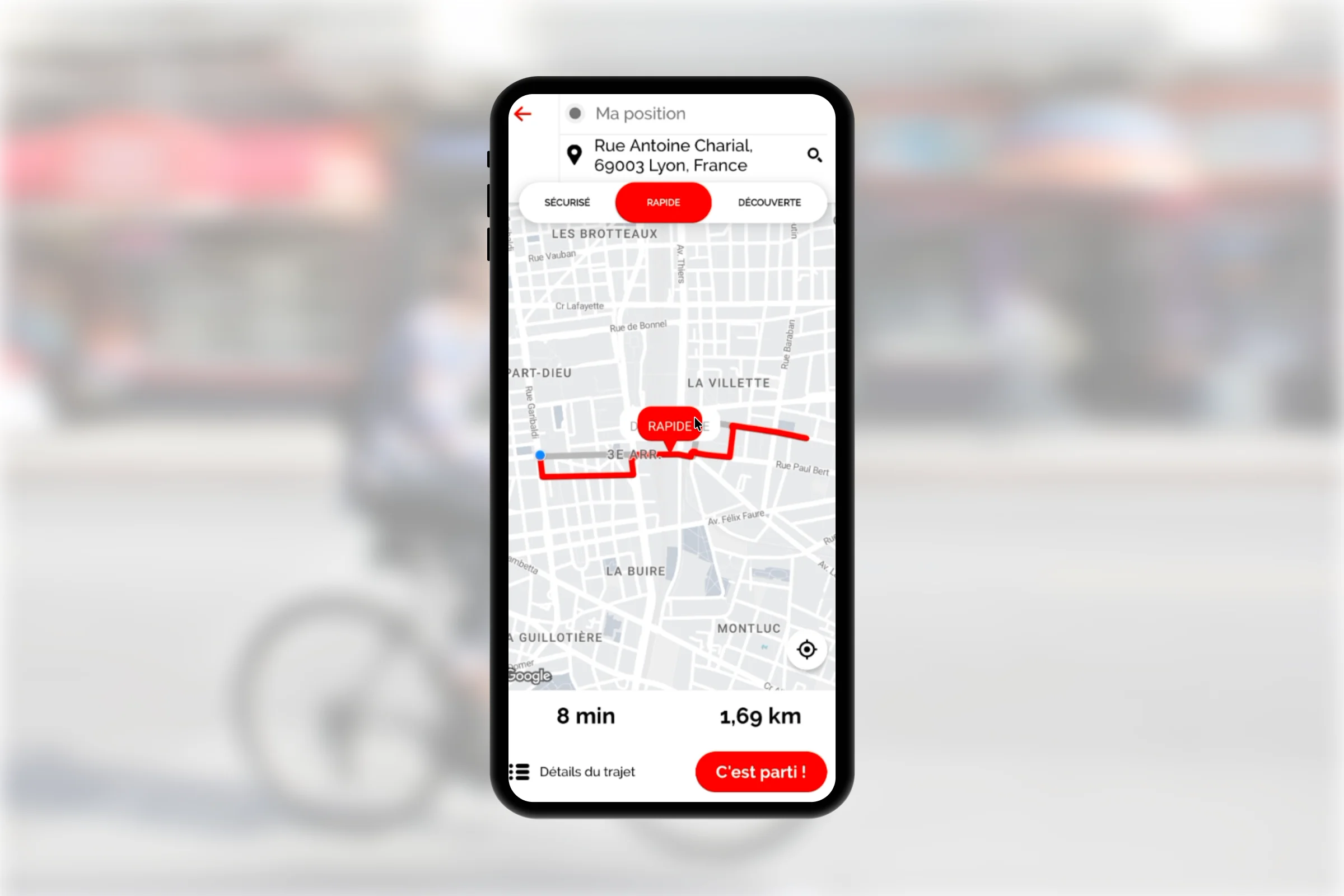

1 000+ daily routes generated
Wemap Routing for calculating optimized cycling routes with short, secure or tourist routes. Disponible via mobile SDKs.
Ready to see Wemap on your networks?
30 minutes with our team — bring your constraints, we bring examples from your sector.