Spatial reference and augmented inspections for industrial sites
Create a visual reference for your site in hours, locate your equipment by AI and boost your field teams' productivity.


 Apave
Apave 
CASE STUDY
RATP deployed Wemap Vision to create an immersive 360° viewer of its metro stations. Maintenance teams explore and annotate spaces from their desk, optimising their operator rounds without a prior on-site visit. The reference is updated by a simple recapture.
See all case studies →85%
reduction in field data creation and maintenance costs (Wemap source, rail basis)
< 5 sec
average on-site positioning time — Wemap Vision, low-cost 360° camera
Hours
to create the visual reference for a full industrial site — not months
On-premise
private hosting available — your data stays with you, no cloud dependency
CHALLENGES
Three industry and facility management challenges that Wemap solves.
No spatial reference
"Our field teams have no spatial reference for our sites — every inspection starts from scratch."
Wemap Vision creates a georeferenced 360° viewer of your site in hours of capture with a consumer-grade camera. Visual reference ready in a day, continuously updated.
Reports not geolocated
"Our inspection reports are not geolocated — impossible to quickly find where a reported issue is."
Wemap generates photo reports automatically geolocated on the site map. Annotations and measurements directly from the viewer. Each issue is located to the nearest metre.
Costly digital twin
"Existing digital twin solutions require LIDAR and expensive industrial sensors — out of our budget."
Wemap Vision uses a consumer-grade 360° camera costing a few hundred euros. Same functional accuracy, without the hardware cost or processing overhead. Accessible to all site sizes.
CAPABILITIES
The Wemap capabilities that make the difference in Industry & Facility Management.
360° viewer & site spatial reference
Low-cost 360° site capture in hours (consumer camera). Georeferenced interactive viewer: visual space navigation, zoom, annotations, measurements. Continuously updated by simple recapture. Secure data: private cloud or on-premise, 100% operator ownership. Standard formats for full reversibility.
For RATP — 360° viewer of metro stations for maintenance, space exploration and annotation by operator teams.
AI detection & localised equipment inventory
Prompt-based search engine (Vision Language Model) on the 360° reference: find equipment, signage or an object by text description. Possible AI model training on your business objects (YOLO, DINO, Segment Anything). Automatically geolocated inspection reports. QR code link for field identification.
For Galeries Lafayette — VLM (Vision Language Model) engine to locate brands, products and equipment by image, 3D annotations and measurements.
REFERENCES
Industry & Facility Management — our references.
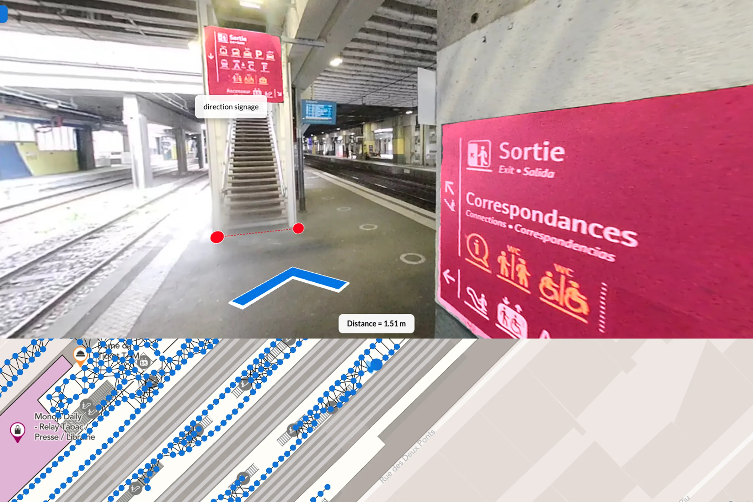
Paris network
Immersive 360° viewer of metro stations — exploration and annotation to optimise operator rounds.
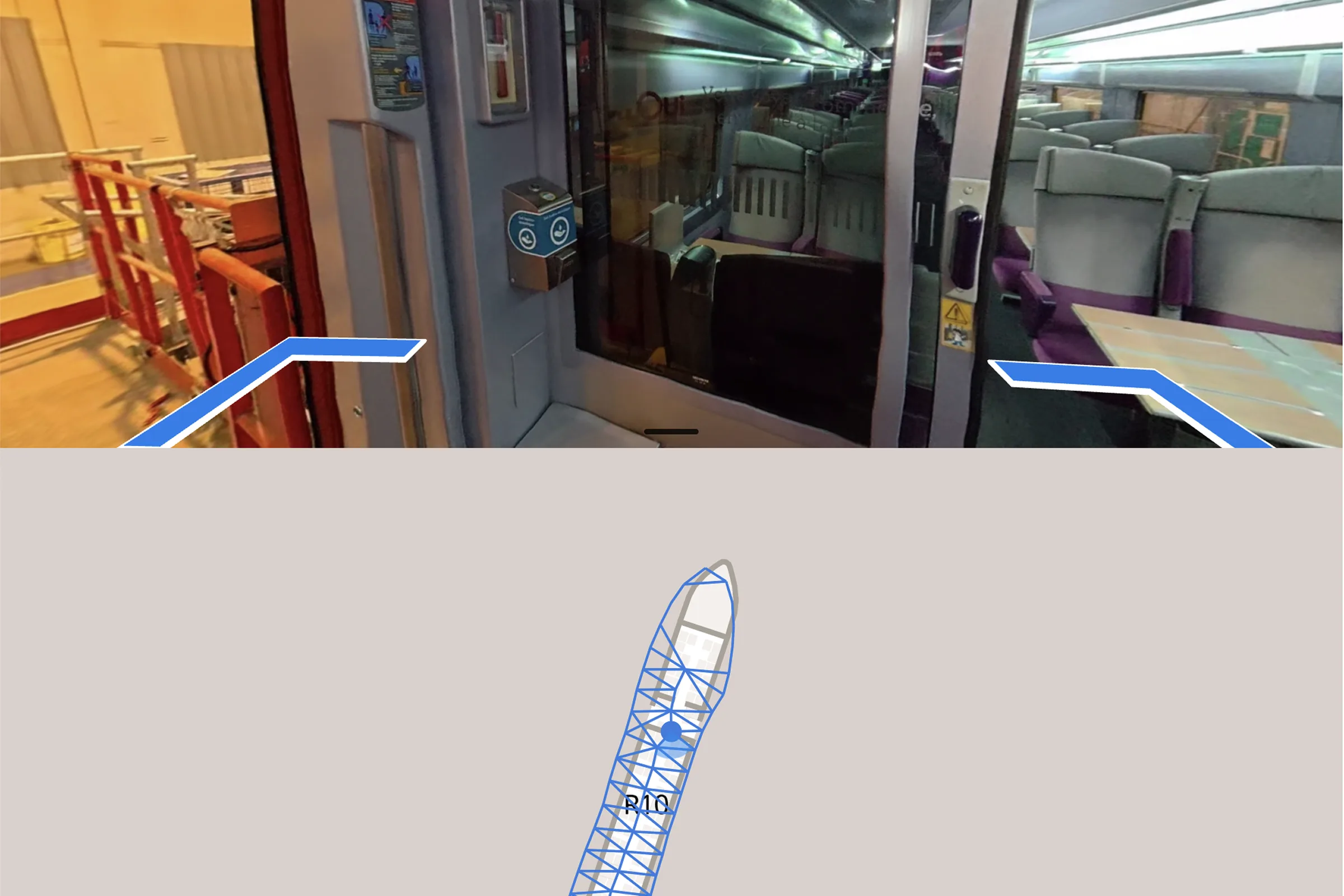
VLM & annotations
AI-powered virtual viewer — 3D annotations, measurements, VLM to locate brands, products, equipment.
Digitised heritage
Cultural assets management — 60,000 m²+, 3,000 artworks synced, viewer for heritage inspection.
AI inspections
Automatically geolocated inspection reports — AI-augmented field productivity, training via virtual tour.
Ready to digitalise your inspections and space management?
30 minutes with our team — bring your constraints, we bring examples from your sector.